
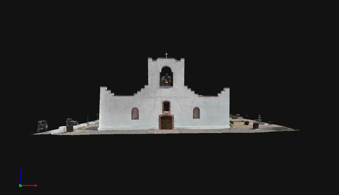
Surveying the Past, Modeling the Future.
By pairing high-resolution aerial photogrammetry with rigorous surveying workflows, Aerial Amity captures historic landmarks in stunning three-dimensional detail bridging preservation, actionable data, and modern digital reconstruction.
Preservation meets the digital world.
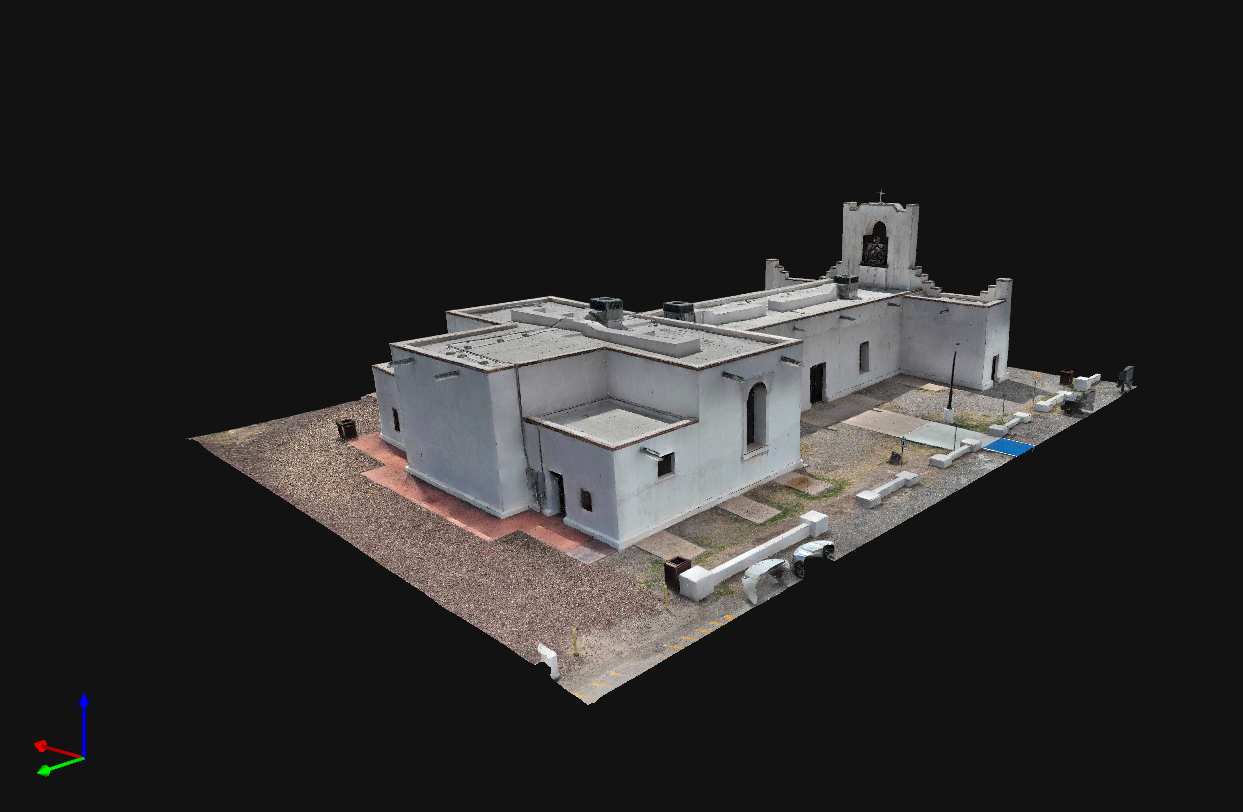
Purpose & Significance
Historic structures like Nuestra Señora de la Concepción del Socorro carry centuries of cultural heritage and architectural history. Traditional surveying and manual documentation methods often struggle to safely capture intricate rooflines, parapets, and weathered adobe surfaces without risking physical disruption to sensitive materials.
What It Enables
Preservation & Structural Health:
Provides historians, architects, and preservationists with an exact volumetric snapshot to monitor weathering, erosion, and structural shifts over time.Modern Surveying Standards:
Delivers actionable 3D point cloud and mesh data for surveyors, engineers, and restoration contractors without the need for intrusive scaffolding or physical contact.Digital Stewardship:
Creates an accessible, permanent digital archive of a Texas landmark, ensuring its history is preserved and measurable for future generations.
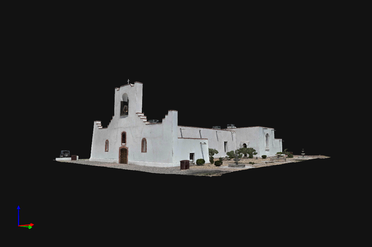
Why This Was Done
Aerial Amity conducted this aerial photogrammetry project to create a millimeter-accurate digital twin of the historic Nuestra Señora de la Concepción del Socorro Mission, capturing thousands of spatial data points across its facade, bell tower, and roof using high-resolution RGB imagery and precision RTK positioning. Developed in partnership with the Texas Society of Professional Surveyors (TSPS), Chapter 17, for the TSPS Seminar 2026, this project serves as an educational outreach initiative to champion STEM throughout the El Paso and Socorro communities. By combining drone robotics, geomatics, and mathematics, the collaboration offers a tangible demonstration of how modern geospatial tools can non-invasively preserve cultural landmarks while inspiring the next generation of surveying professionals.
Collaboration Across Multiple Industries
Community Outreach & Industry Collaboration
This project originated as an educational outreach initiative in partnership with the Texas Society of Professional Surveyors (TSPS), Chapter 17. Recognizing the vital role modern aerial photogrammetry plays in the future of land surveying and historical preservation, Aerial Amity collaborated with Chapter 17 to demonstrate real-world, high-precision remote sensing workflows.
Presented during the TSPS Seminar 2026, this digital reconstruction served as a live case study illustrating how drone photogrammetry, RTK positioning, and photogrammetric control bridge the gap between traditional boundary surveying and advanced 3D spatial modeling—all while giving back to our local community by documenting one of the region’s most historic landmarks.

Facts About Modeling the Socorro Mission.
How much data?
3,895 High-Resolution Aerial Images
1.8 Billion Resolved 3D Spatial Points
105 Hours Dedicated Photogrammetric Processing
7 Calibration & Reconstruction Iterations
How was it made?
Photogrammetry & Spatial Engine: PIX4Dmatic
Aerial Platform: DJI Matrice 4 Enterprise
Survey & Geodetic Control: Trimble R8 GNSS
Workstation: Intel Core i9-14900K RTX 4090 GPU