

Firecracker Pueblo.
A late period pueblo site in El Paso Texas.
A Historical Overview.
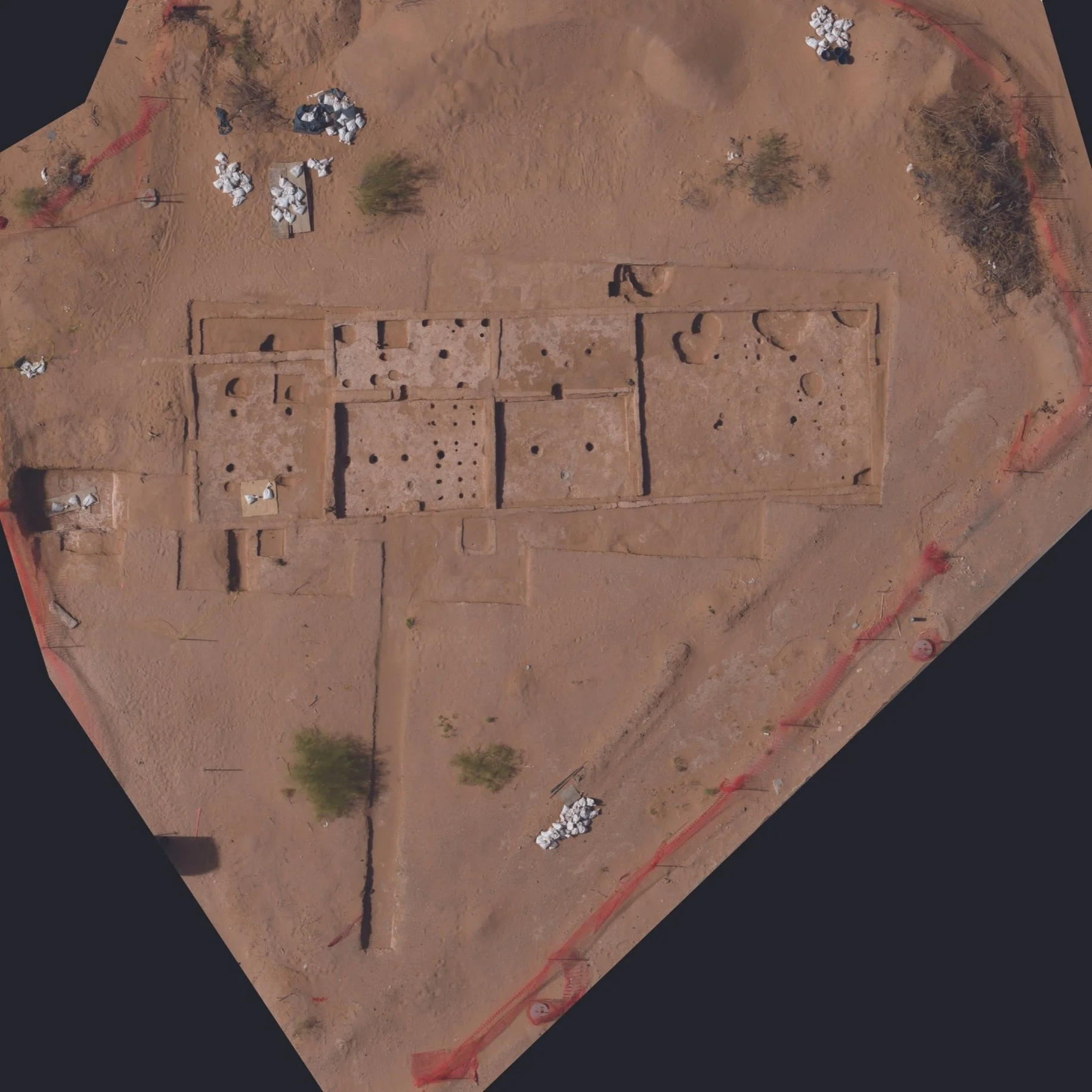
Located in northeast El Paso, the Firecracker Pueblo is a 15th-century State Archeological Landmark. This site provides a unique window into the Jornada Mogollon culture, revealing the transition from pit house residences to a developed adobe pueblo. Ongoing archaeological efforts continue to uncover details about this important historical settlement.
Info about the Firecracker
Named for Fireworks Stands: The site earned its unique name, "Firecracker Pueblo," because temporary fireworks stands were set up near the excavation area during early archaeological work.
A "Late Bloomer" Pueblo: Firecracker Pueblo is one of the latest known examples of a Jornada Mogollon pueblo, showcasing the culture's presence in the region well into the 15th century.
Architectural Evolution on Display: The site provides clear evidence of a significant architectural shift, with residents transitioning from living in circular pithouses to constructing a multi-room adobe pueblo.
Decades of Discovery: Extensive archaeological excavations at the site spanned over ten years, beginning in 1980, involving numerous volunteers and members of the El Paso Archaeological Society.
Proof of Mobile Puebloans: Investigations at Firecracker Pueblo helped confirm that pithouses, often seen as permanent dwellings, could also be short-term or seasonal occupations by Puebloan peoples.
Modern Day Protectors: The Texas Department of Transportation (TxDOT) works closely with the Tigua Indians of Ysleta del Sur Pueblo, the only Puebloan tribe still in Texas, on projects that impact the site, honoring its historical significance.
3D model.
Leveraging Pix4Dmatic, archaeologists can meticulously create a high-fidelity 3D digital twin of the pueblo, capturing every nuance of its architectural features and the surrounding archaeological context. This advanced photogrammetry software facilitates the precise documentation of stratigraphy and structural remains, offering an invaluable dataset for both detailed academic study and long-term site preservation. The resulting orthomosaic and dense point cloud enable researchers to conduct virtual analyses, measure architectural elements, and track any future degradation of the site with unprecedented accuracy.
Online Cloud Viewer
View, measure, and interact with the Firecracker Pueblo with Pix4D Cloud. Photogrammetry is the technique of creating precise 2D maps and 3D models by taking measurements from multiple photographs. It's incredibly useful for capturing accurate, detailed representations of real-world objects and landscapes for industries like surveying, construction, and archaeology.
Pix4D Cloud builds on this by providing an online platform where users can upload drone and ground-captured imagery to be processed using photogrammetry, generating these detailed 2D maps and 3D models for easy analysis, progress tracking, and sharing.